
Three distinct parcels and 200 m² of registered ruins on the Rio Velerin
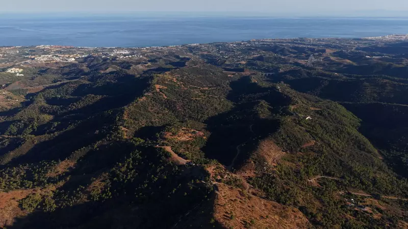
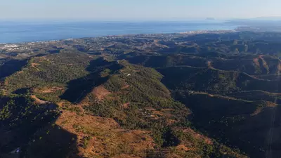
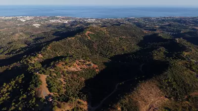
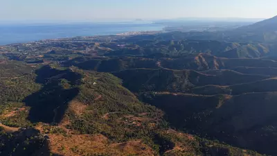
Three kilometres of direct frontage along the Rio Velerin define the boundary of this 615,000 m² estate between Estepona and Marbella. As a substantial parcel of land with ruin in Estepona, the property combines a massive agricultural footprint with a documented built area of 200 m². It is offered either as a single holding of 61.5 hectares or divided into three separate plots, giving a buyer flexibility in how the acquisition is structured.
How the three plots divide the estate
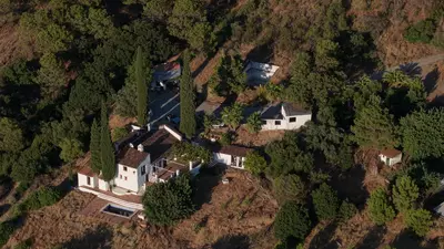
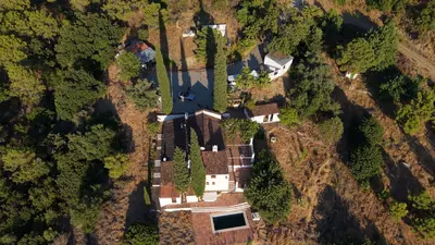
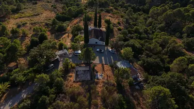
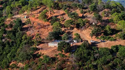
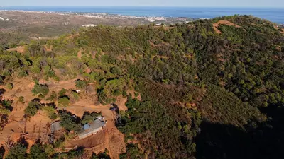
The largest section, known as Plot 1 or Burca House, covers 450,820 m² and forms the agricultural core of the holding, historically planted with olives, grapes and mangoes. It contains the primary structure, which sits on foundations believed to date from the Roman era. Plot 2, called Eagles Nest, spans 95,000 m² of elevated ground and commands the clearest panoramic views across the Mediterranean to Gibraltar and the African coast. Plot 3, The Amphitheatre, measures 71,808 m² and sits within a natural topographic bowl that screens it from the surrounding hills.
Planning basis and the 2002 registry
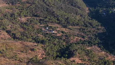
Rural land in Andalusia is strictly regulated, which makes the existing paper trail the most critical asset of this land with ruin in Estepona. The property specifications record a 200 m² built area, and a 2002 property registry entry confirms the presence of several ruined houses and an abandoned village within the boundaries. For anyone planning reconstruction, that registry entry is the starting point for establishing legal footprints and volume rights with the municipal planning department. Neighbouring plots in the immediate area have already been developed into large single-family residences of roughly 1,400 m², setting a local precedent to examine during legal due diligence.
Road access and internal tracks
Reaching a plot of this scale often requires long drives over unpaved municipal tracks, but this estate connects directly to the A7 coastal highway via an asphalt road. The drive to San Pedro de Alcántara takes twelve minutes. Inside the perimeter, seven kilometres of private tracks link the three parcels, the river boundary and the elevated viewpoints, meaning the basic circulation across the 61.5 hectares is already cut into the terrain.
What a buyer must verify before offering
An acquisition of this nature rests on urbanistic and hydrological checks rather than a standard building survey. A buyer's lawyer and architect will need to cross-reference the 2002 registry documentation and the 200 m² built figure against the current Estepona general plan and regional rural land laws to confirm exact rebuild allowances on each of the three plots. Note that the individual plot figures announced in the estate breakdown total slightly more than the 615,000 m² headline figure, so a topographic survey and cadastral reconciliation will be required. Utility connections, water extraction rights along the Rio Velerin, and the precise boundaries of the three master plots should also be established early in the process.
Can the estate be purchased in smaller sections rather than as a whole?
Yes, the land with ruin in Estepona is available either as a single 615,000 m² holding or divided into three separate plots. These individual parcels measure 450,820 m², 95,000 m² and 71,808 m² respectively.
What existing structures are documented on the land?
The authoritative property data lists a built area of 200 m². In addition, a 2002 property registry record confirms the existence of several ruined houses and an abandoned village on the site, including a main structure believed to sit on Roman foundations.
How is the property accessed from the coast?
An asphalt road leads directly from the A7 highway to the estate, placing it twelve minutes by car from San Pedro de Alcántara. Within the boundaries, seven kilometres of private internal tracks provide access across the terrain.
Does the land have sea views and water frontage?
The estate is bordered by three kilometres of the Rio Velerin. The elevated 95,000 m² parcel, known as Plot 2, has panoramic sea views reaching across the Mediterranean to Gibraltar and the coast of Africa.
What has the land been used for historically?
Over its documented history, the estate has functioned as a commercial farm and a private shooting retreat. The largest plot has been used for growing olives, grapes and mangoes.
61.5-Hectare Land with Ruin in Estepona
Property Description
This version incorporates the comparison to Monaco, the specific historical legalities from the 2002 registry, and the breakdown of the three plots. This is designed to capture the attention of high-level developers and "trophy property" hunters on Resales-online.com.
MAGNIFICENT LEGACY ESTATE: A Private Kingdom 1/3 the Size of Monaco
Headline: 615,000m² Historical Estate with 3 Prime Plots – The "New La Zagaletta" Opportunity
The Opportunity Rarely does a land acquisition of this magnitude and historical significance reach the open market. Spanning a staggering 615,000 m² (approx. 61.5 hectares)—representing nearly 1/3 the total land mass of Monaco—this magnificent finca offers an unparalleled "land bank" opportunity between Marbella and Estepona. Bordered by 3km of the Rio Velerin and featuring 7km of private internal tracks, this is a private kingdom with limitless potential.
Proven Development Potential This is not merely rural land; it is a site with a documented architectural footprint.
Historical Footprint: A 2002 property registry confirms the existence of several ruined houses and an entire abandoned village on the estate, providing a vital legal basis for reconstruction and redevelopment.
Precedent for Luxury: The immediate neighborhood has already seen the successful development of 15,000 sq. ft. palatial residences, mirroring the exclusivity and scale of La Zagaleta.
Three Distinct Investment Plots The estate is strategically divided into three "Master Plots," each offering unique characteristics:
Plot 1: Burca House (The Historical Heart): 450,820 m² including the primary residence believed to be built on Roman foundations. The center of the estate’s agricultural soul (Olives, Grapes, and Mangoes).
Plot 2: Eagles Nest (The Viewpoint): 95,000 m² of elevated terrain. This plot offers the most dramatic panoramic views of the Mediterranean, Gibraltar, and the African coastline.
Plot 3: The Ampitheatre (The Sanctuary): 71,808 m² featuring a unique natural bowl topography, offering total privacy and perfect acoustics for a secluded retreat or wellness oasis.
A 2,150-Year Legacy Steeped in over two millennia of history, the estate has served as a Roman outpost, a thriving commercial farm, and a private shooting retreat. Despite its absolute privacy, it is exceptionally connected—located just 12 minutes from San Pedro de Alcántara via a high-quality asphalt road directly from the A7 highway.
Key Features at a Glance:
Total Land: 615,000 m² (1/3 the size of Monaco).
Legal: 2002 Registry confirms ruined houses and abandoned village.
Water: 3km of direct Rio Velerin frontage.
Infrastructure: 7km of internal roads and direct A7 access.
History: Roman-era foundations and 2,150 years of agricultural heritage.
Flexibility: Available as a whole or as three individual plots.
This is a once-in-a-lifetime acquisition for a visionary developer or a private family office looking to secure a historical legacy in the sun. Offers are currently being invited.
Download the Exposé!
Do you want to receive more photos, prices, fees and taxes of this property?
Visit this Property?
Interested to make an appointment with us to take a personal look at this property?
More photos? More infos?
Just fill out the form below and we deliver.
You want to see it?
Just fill out the form below for an appointment.
Share this property
We send this property to the address you enter here.